Radius map
Measures the same straight-line distance in every direction. It is quick, but it does not reflect whether the route is actually usable.
Create a free isochrone or drive-time map around a selected location where routing coverage is available. Compare 5–60 minute driving, walking and cycling catchments.
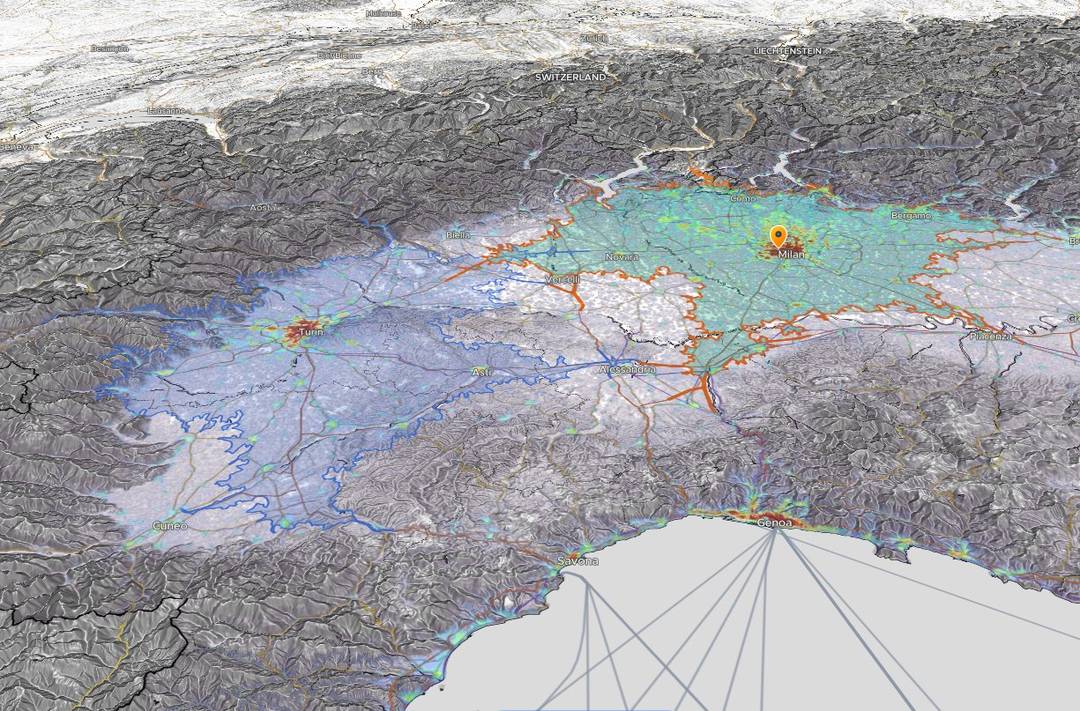
Actual Horizon Mapper output: two drive-time areas shaped by the mapped road network.
An isochrone shows every place reachable from one origin within a chosen travel time. Unlike a fixed-radius circle, its boundary follows the mapped road and path network.
This page leads directly into the working map. No GIS software or desktop install is required.
Search for a place or select an origin directly on the map.
Choose driving, walking or cycling, then set the travel-time limit.
Create the isochrone, inspect the reachable area and add context layers.
Distance and travel time answer different questions. Use the one that matches the decision.
Measures the same straight-line distance in every direction. It is quick, but it does not reflect whether the route is actually usable.
Follows the mapped transport network, so roads, bridges, one-way streets and mapped barriers shape the area. Elevation can affect walking and cycling profiles.
Isochrones turn a location into an operational catchment, making access easier to compare and explain.
Compare multiple zones, add population and accessibility layers, inspect points of interest, and keep the map connected to the decision you are making.
How to read an opportunity scoreThe essentials before you open the map. For routing limits and data sources, see the methodology page.
An isochrone map shows the area that can be reached from a location within a chosen travel time. Its boundary follows the transport network rather than a fixed straight-line distance.
Open Horizon Mapper, search for or select an origin, choose driving, walking or cycling, set a travel time between 5 and 60 minutes, then generate the zone.
A radius map measures equal straight-line distance in every direction. An isochrone follows the mapped road and path network, so bridges, one-way streets and mapped barriers can change the reachable shape. Elevation can affect walking and cycling profiles.
Yes. Choose the driving profile and a duration from 5 to 60 minutes to create a drive-time catchment around your selected origin.
Yes. Horizon Mapper includes walking and cycling profiles as well as driving, so you can compare how the reachable area changes by travel mode.
Yes. Driving, walking and cycling isochrone generation is included in Horizon Mapper's free core map; no desktop GIS install is required.
Pick a location, choose a mode and let the transport network draw the reachable area.